Amazing Landscapes of Philippines
Most images are linked, just tap and will lead you to the details
Discovery-Guelos - Green Earth Awareness 2024


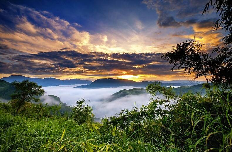
Sierra Madre - The Magnificent Frontier of the Philippines
Philippines, 08 October 2023

In the north, the range begins in the province of Cagayan and ends in the south in the province of Quezon. In the province of Nueva Vizcaya, the Caraballo Mountains sits between Sierra Madre and Cordillera Central. The mountain range serves as a typhoon barrier, weakening incoming typhoons from the Pacific Ocean before reaching the central mainland. The range's highest point is still unsure, and several peaks are recognised as the highest. Mount Anacuao in Aurora province stands at 6,069 feet (1,850 m), while Mount Cetaceo in Cagayan is of similar altitude. However, an expedition in September and October 2012 to Mount Guiwan (Nueva Vizcaya) preliminarily measured an altitude of 6,283 feet (1,915 m) on the summit.
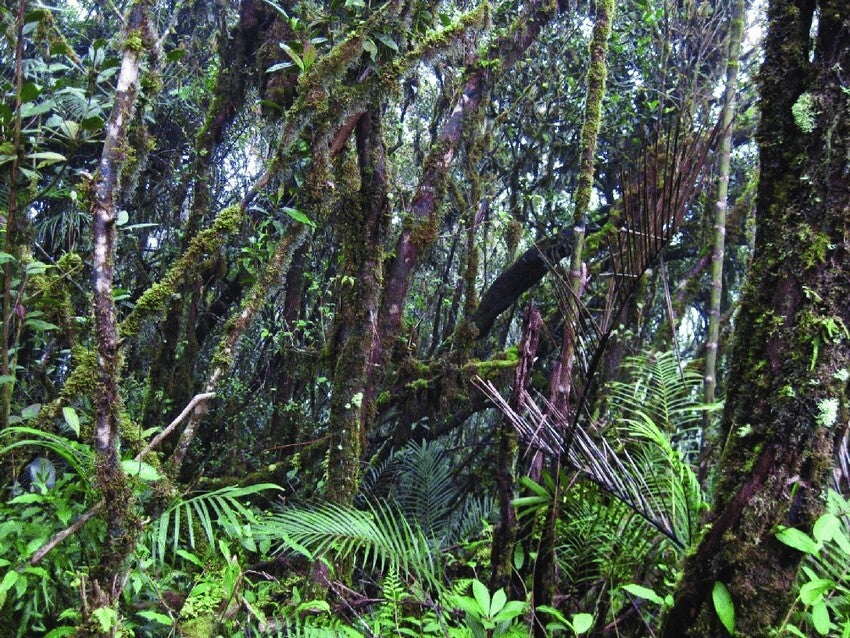
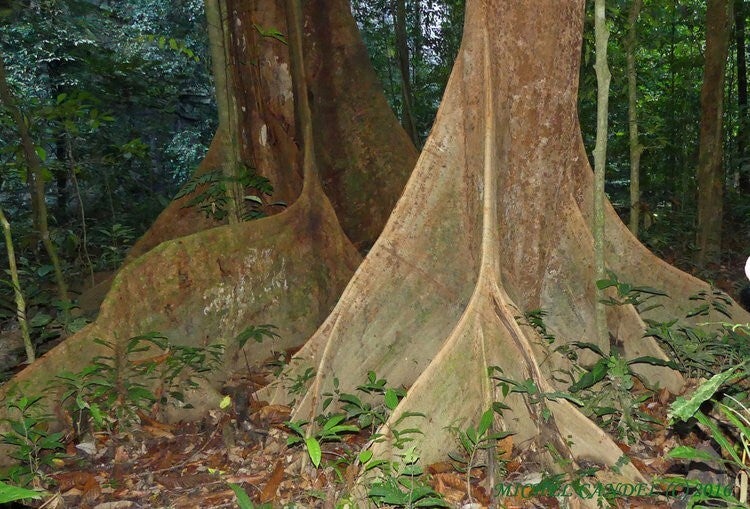
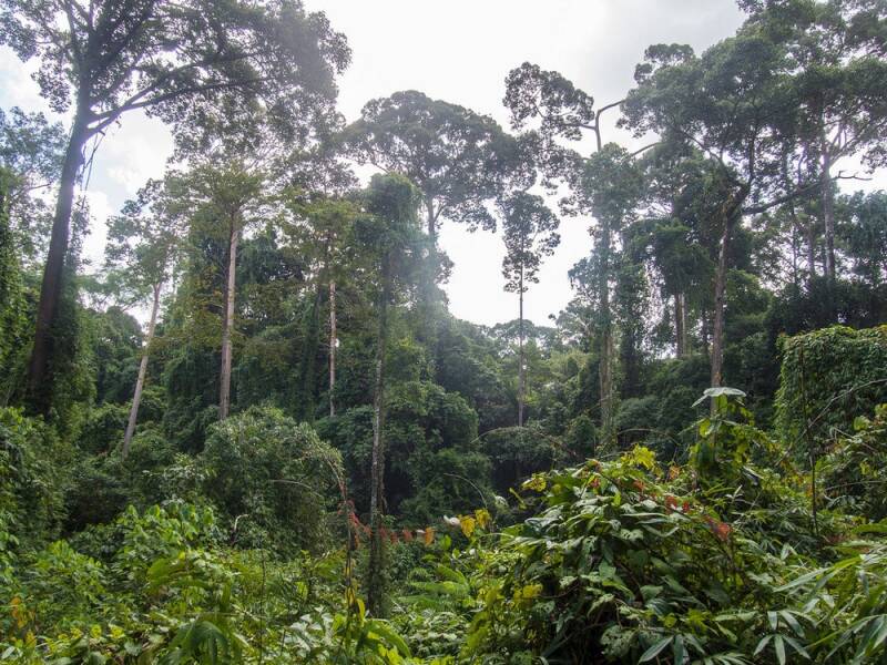
There are many mountain peaks along the range by elevation approximately measuring from highest which is Mount Bintuod at 6,339 ft (1,932 m) to the lowest which is Mount Malauban at 1,024 ft (312 m). Numerous rivers running within the mountain range from the longest, the Cagayan river at 518 km (322 miles) and the shortest is Kaliwa river at 518 km (322 miles). The Sierra Madre has 9 waterfalls of various stretch and wide. The mountains in Gabaldon and the mountains in Isabela as viewed from Barangay Diddadungan in the town of Palanan Northern portion of the range are two ecoregions cover the Sierra Madre. The Luzon rain forests cover the lower slopes of the range, and characterized by dipterocarp trees, or Dipterocarpaceae is a family of 16 genera and about 695 known species of mainly tropical lowland rainforest trees. The Luzon montane rain forests cover the portions of the range above 1000 meters elevation, and are characterized by laurel forests of oak and laurel trees. And there is one active volcano, the Caqua volcano in Cagayan province and last erupted in 1907.
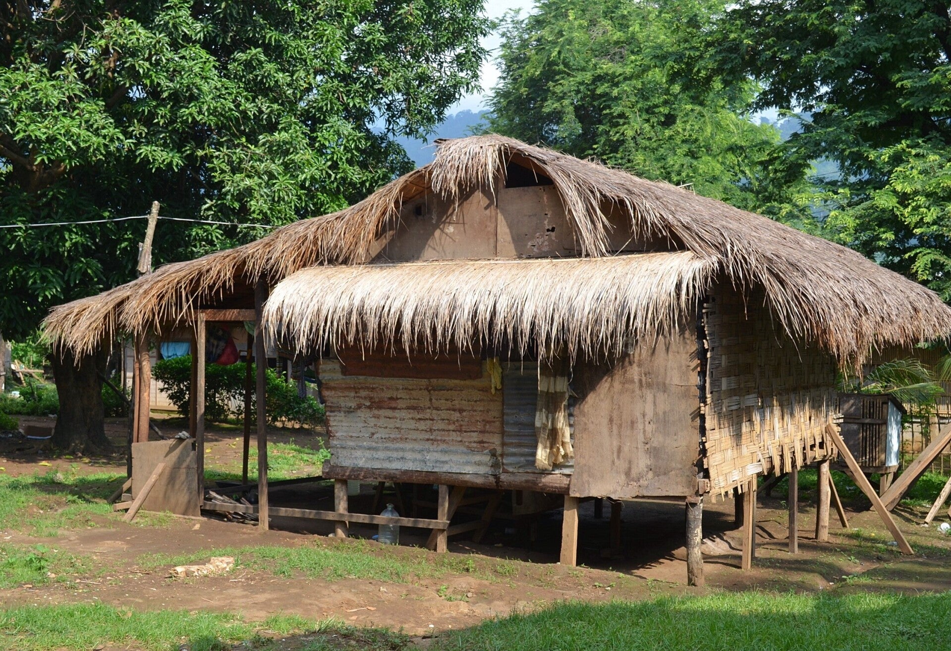


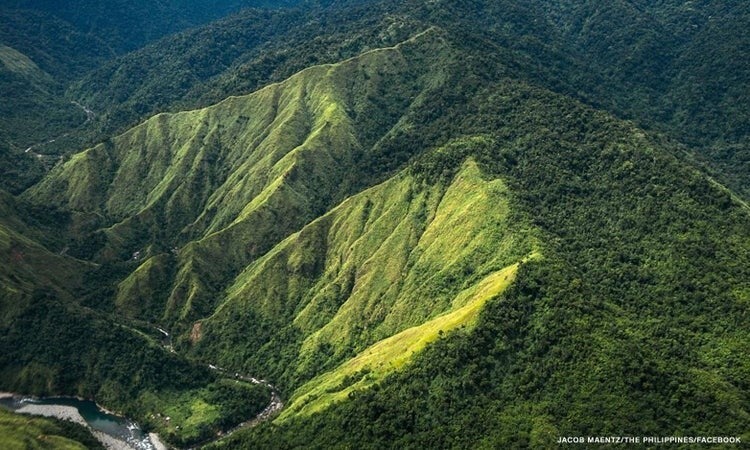


The Philippines Sierra Madre is the longest mountain range in the country, traversing over 540 kilometers (340 mi) stretching from the province of Cagayan down to the province of Quezon, forming a north–south direction on the eastern portion of Luzon, the largest island of the archipelago. It is bounded by the Pacific Ocean to the east, Cagayan Valley to the northwest, Central Luzon to the midwest, and Calabarzon to the southwest. Some communities east of the mountain range, along the coast, are less developed and extremely remote that they could only be accessed either by air or sea. It is the Philippines largest protected area, the Northern Sierra Madre Natural Park, located at the northern part of the range in the province of Isabela. The park is included in the UNESCO tentative list for World Heritage List inscription. Environmentalists, scholars, and scientists have been urging the government to include the other parks within the Sierra Madre mountains for a UNESCO site that would include the entire mountain range from Cagayan to Quezon.
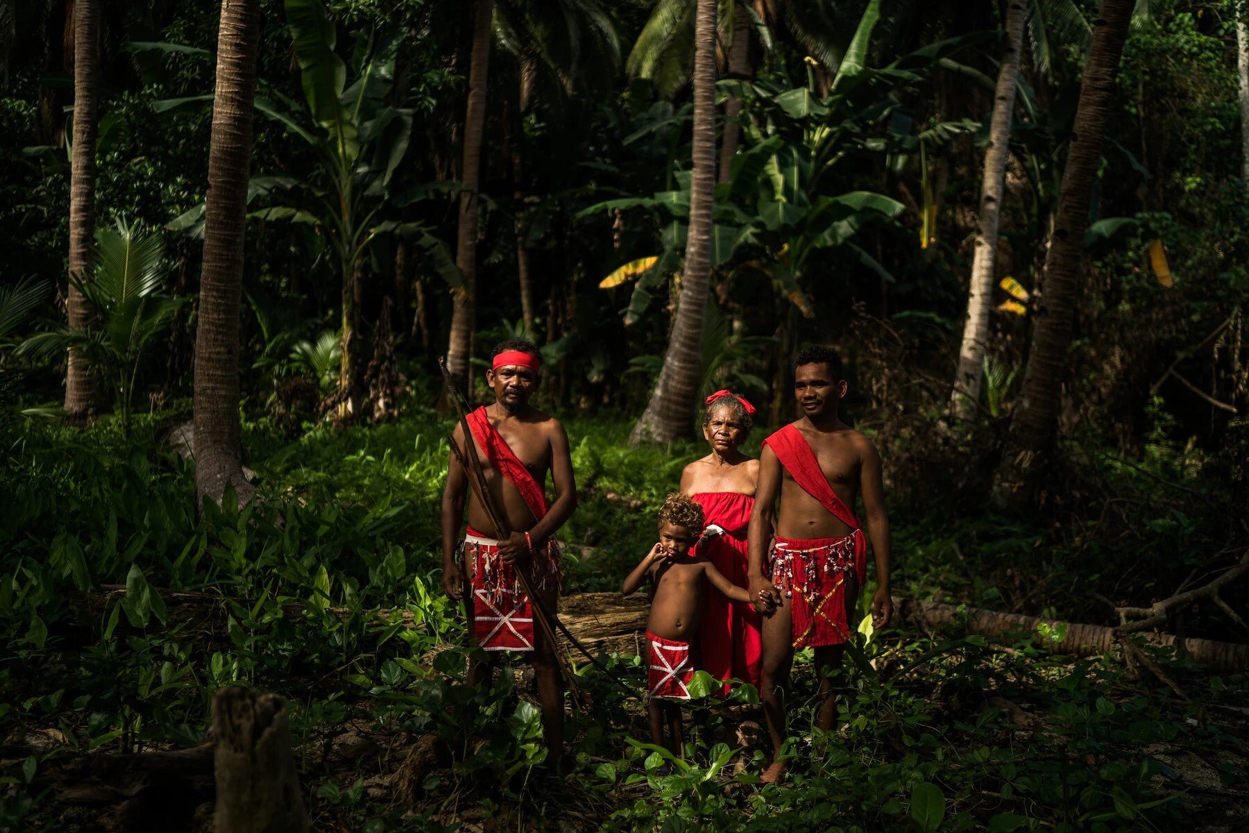
Sierra Madre is home to Indigenous Dumagat-Remontado groups, are the Aeta or Agta, or Dumagat, a collective terms for several indigenous Filipino peoples who live in various parts of the island of Luzon communities who have ancestral domain claims covering parts of the mountain range. Aeta communities were historically nomadic hunter-gatherers, typically consisting of approximately 1 to 5 families per mobile group. Groups under the "Aeta" umbrella term are normally referred to after their geographic locations or their common languages.
The Sierra Madre mountain range is rich in genetic, species, and habitat diversity, supplying food, water, and shelter to millions of people. The mountain range holds multiple watersheds and some of the Philippines' oldest forests. These forests are some of the country's largest remaining forest blocks, including an old-growth dipterocarp forest, montane forests, and extensive lowland forests. Sierra Madre's forests and watersheds are home to some of the country's richest wildlife communities of more than 291 species of birds and 25 endemic mammals may be found within the Northern Sierra Madre Natural Park alone.
Sources:
-
Coursey, Oscar William (1903). History and Geography of the Philippine Islands. Educator School Supply Company.
-
Bordadora, Norman (November 12, 2006). "Sierra Madre blocks 'Queenie' punch". Philippine Daily Inquirer. Archived from the original on December 25, 2014. Retrieved December 25, 2014
-
Noval-Morales, Daisy Y. "The Remontados of the Sierra Madre Mountains". National Commission for Culture and the Arts. Retrieved April 10, 2021.
-
Centre, UNESCO World Heritage. "Northern Sierra Madre Natural Park and outlying areas inclusive of the buffer zone". UNESCO World Heritage Centre.
-
"Northern Sierra Madre Natural Park". forestry.denr.gov.ph. Archived


The thousands of islands in the Philippines
Play the video selections and be amazed
Destination: Palawan, Philippines
Video Courtesy of Palawan Tourism
Travel video courtesy of Touropia
Destination: Negros Oriental, Philippines
Video Courtesy of Dumaguete Tourism
Manila, Philippines (Video courtesy of Exploropia)
Destination: Ilocos Norte, Philippines
Video Courtesy of VPI Travel Ilocos
