Explore Scenic Places in the Philippines
Short historical facts and stories about places in the Philippines. Travel tour deals also available.


Guimaras Islands, The Impeccable Getaway Sanctuary Iloilo,Philippines


Spanning the boundary between the islands of Panay and Negros, Guimaras Island is offered with a superb location in the Panay Gulf. Renowned for its immaculate beaches, wide range of accommodations and huge selections of activities, and the sweetest mangoes that can’t be found anywhere in the world, Guimaras Island is indeed the ultimate tropical destination. Guimaras has a population of approximately 170,000 hospitable residents, Guimaras Island is more than just a tourist destination—it has a thriving community with an interesting history, incredible landmarks, and a great sense of environmental and agricultural responsibility.
Guimaras is considered one of the most pristine islands in the Philippines. Its original name was “Himal-us” but was later changed to “Guimaras” after the folktale of the ill-fated lovers, Princess Guima and the slave Aras, who defied tradition with their romance. The island was once a sub-province of Iloilo but by the virtue of R.A. 7160, it was proclaimed a regular province on May 22, 1992. The province of Guimaras is comprised of a mainland and clusters of small islands and islets. The mainland dominates in terms of land area, about 98 percent of the total provincial area. The 42 islets, which encompass Taklong islands are utilized for marine research activities.


The province is basically agricultural with palay, coconut, mango, vegetables, livestock, poultry and fishing as major products. Its major industries are tourism, fruit processing, coconut processing, fish farming, handicrafts making, mining, quarrying , and lime production. Guimaras is well known for its agricultural crops, particularly mangoes, where some 50,000 of these trees are planted. The Guimaras Island is famous for producing some of the sweetest mangoes in the world. Guimaras mangoes are reportedly served at the White House and Buckingham Palace. Guimaras’ largest event of the year is The Manggahan Festival (the Mango Festival). The variety of mangoes produced are also used for making dried mangoes, jam and other delicacies.


Guimaras is surrounded by a body of water in which Guimaras Strait comprises the largest of the western side of the island. It is the most important water body used for navigation. Large and small boats going in and out of the provinces of Iloilo and Guimaras pass through the Strait, making it an important economic driver that facilitates economic activities for both provinces. There’s plenty to do during your Discover Guimaras holiday. Enjoy a wide selection of island and mountain resorts offering an abundance of water sports and activities; visit historical and religious sites that introduce the dynamic and vibrant history of the island; experience different adventures via the ecotourism and agritourism sites; traverse in glowing freshwater caves, and participate in year-round events and festivals depicting the cultural heritage of Guimaras Islands.


About 1581, Gonzalo Ronquillo de Peñalosa, Spanish governor and Captain-General of the Philippine Islands, established a settlement in Guimaras for the purpose of the Christianising the island’s natives. He and his subordinates organized the pueblicitos or villages of Nayup under the patronage of Saint Peter the Apostle, and Igang, with Saint Anne as patroness. Guimaras first gained its status as a sub-province of Iloilo by virtue of R.A. 4667, which was enacted by the Congress on 18 June 1966. It was proclaimed as a regular and full-fledged province on 22 May 1992 after a plebiscite was conducted to ratify the approval of its conversion pursuant to Section 462 of R.A. 7160. Shortly after Guimaras acquired its provincial status, President Fidel V. Ramos appointed Emily Relucio-Lopez as its first Governor.


Drench in the Crystal Clear Beaches of Panglao, Bohol,Philippines


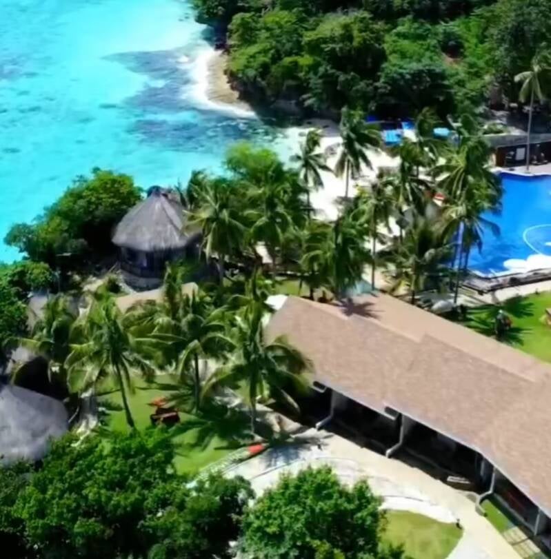
Panglao is situated in southernmost part of Bohol. It is one of two municipalities that make up Panglao Island (the other being Dauis). Panglao is known for its diving locations and visitors resorts It has historical significance where the Spaniards in 1803 went after an unfortunate experience in Cebu. The name Panglao may have come from its former name Panglawod, meaning "to the open sea",or derived from the word panggaw, referring to a fishing implement used by locals. Panglao, officially the Municipality of Panglao is a 4th class municipality in the province of Bohol, Philippines. According to the 2020 census, it has a population of 39,839 people. Panglao is known for its diving locations and visitors resorts .


Panglao has educational institutions, including the San Agustin Academy (Panglao), Lourdes National High School, the Cristal e-College, and elementary schools located in every barangay (including the Panglao Central Elementary School). It is also home to Bohol–Panglao International Airport that serves as Bohol's primary airport, replacing Tagbilaran Airport in November 2018. The town of Panglao, Bohol celebrates its fiesta on August 27–28, to honour the town patron Saint Agustine.
Panglao before the Spanish colonization, the area was already long visited by Chinese and other Asian traders, as verified by archaeological finds of Tang, Song, and Ming dynasty porcelain and trade wares. Panglao grew during the rule of the Dapitan kingdom, but raids by Moluccans and conquest by Ternate resulted in periods of depopulation when its population fled mostly to Panay and Mindanao, including Dapitan. During the Spanish rule, a Jesuit mission post was established, that in 1782 was formed into a parish, known as La Iglesia de San Agustin de Panglawod. In 1803, the town was officially made into a municipality. The Panglao watchtower was built in 1851. The 5-storey octagonal tower is the tallest of its kind in the Philippines but suffers from neglect. The municipality occupies the southwestern part of the scenic Panglao Island, and its territory also includes the three smaller islands of Balicasag, Gak‑ang, and Pontod (or Pungtud, also known as Virgin Island). It is 20 kilometres (12 mi) from Tagbilaran. There are no fresh water streams or lakes on the island, so for its drinking water, the municipality is dependent on wells and the Canhilbas Underground Spring.
Top Hotels and Resorts in Panglao
Click the linked images for details

Hennan Alona Beach Resort
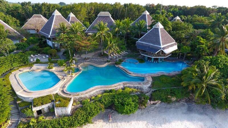
Mithi Resorts Panglao
Top three beaches in Panglao, Bohol
Alona Beach, Dumaluan Beach and Danao Beach


Top RestoBar and Cafe in Panglao


Immerse in Wilderness of Bukidnon,Philippines
Most images are linked for more details about Bukidnon


The Province of Bukidnon is located at the centre of Mindanao Island, southern part of the Philippines. It is a surrounded by land province bounded on the North by the City of Cagayan de Oro, on the South by North Cotabato and Davao City, on the East by Agusan del Sur and Davao del Norte, and on the West by Lanao del Norte and Lanao del Sur. Occupying a wide plateau in the North Central part of Mindanao, Bukidnon has a progressive agriculture-based economy. Having the biggest agricultural area with soils and climate highly suited to agriculture, Bukidnon is the main source of agricultural products and raw materials that feeds the processing plants within the province and the major processing centres of the region, hence, Bukidnon is tagged as the region’s “Food Basket”. Bukidnon is noted for its succulent and sweet pineapples. The pineapple plantation of Del Monte alone is over 10,000 hectares. The province also leads in rice production in Northern Mindanao. Aside from pineapple and rice, vast areas of land are planted with sugar cane, corn and banana which are its basic agricultural crops. Its mineral deposits include gold, manganese, chromite, raw materials for construction, feldspar, limestone, silica and guano. More than half of its land area are forestland which are rich sources of timber, rattan and other forest products.
Monastery of Transfiguration


Bukidnon is also labelled as the highland paradise in the heart of Mindanao. It is predominantly a rolling grassland plateau with an average elevation of 915 metres. The rolling uplands, deep canyons and valleys alternating with the low plains create a refreshing vista for dwellers and travellers alike. The refreshing cool climate in the Bukidnon plateau is attributed to its fairly high altitude. Aside from its rich natural heritage, Bukidnon is the home of seven indigenous cultural communities: Talaandig, Higa-onon, Bukidnon, Umayamnon, Matigsalug, Manobo and Tigwahanon.
The province's terrain is characterized by deep ravines and thickly forested mountains which protect the province from storms. Bukidnon means "people of the mountains" and was named after the tribes who inhabited the mountains of the area. The province constituted one of the six districts of Mindanano during the Spanish regime. It subsequently became a sub-province of Misamis during the American era. The 20th centruy saw heavy migration of people to Mindanao thereby increasing the number of settlements in the area. In 1903, Bukidnon was made a separate province and was formally recognized as such on March 10, 1917 under Republic Act No. 2711. Majority of the residents of Bukidnon are Cebuanos, followed by Panay-Hiligaynons, Manobos, Muslims, other Visayans, Tagalogs and Ilocanos


Malaybalay City is the provincial capital of Bukidnon. It’s settled in a charming rural environment, elevated at about 620m, surrounded by mountain ranges from all sides. Malaybalay parallels to Baguio City, but it is smaller in size, unspoiled and spacious location on a wide plateau. The climate is milder but still quite fresh at night. It is protected from storm as it is far south from the Typhoon belt and also from landslides, as the mountains in Bukidnon are not as steep as they are in the Cordilleras.
The Beauty of Bukidnon
Though Bukidnon is known to be Mindanao’s Food Basket, it’s stunning visuals and vividness are not often cited or highlighted. This surrounded by land province in Northern Mindanao is just the perfect image of the countryside, from vast highlands, deep canyons, and valleys to rolling grasslands, Bukidnon offers quite a picturesque landscape that is ideal for both adventure seekers and visitors looking for some quality relaxation. From the Visayan term “bukid” which means mountain, Bukidnon is not short on mountains and mountain ranges. Kitanglad Mountain Range and Kalatungan Mountain Range are the famous ones, especially for mountain climbers. In general, Bukidnon is a rolling grassland with uplands, canyons, and valleys with noticeable elevations. This is the reason why Bukidnon is relatively cool and moist throughout the year. Bukidnon may not have pristine beaches that will surely attract visitors, nevertheless, they offer natural springs and refreshing waterfalls that you can still enjoy and dip into. Most of its natural hot springs are even turned into resorts like MGM Mountain Resort and Waig Crystal. While the most popular waterfalls you can visit are Limunsudan Waterfalls, Alalum Waterfalls, and Balisbisan Curtain Waterfalls.
Heritage sites and other scenic spots offer another side of the place for visitors. Places like Daraghuyan Heritage Centre, Ereccion de Pueblo, and The Monastery of the Transfiguration are some of the popular icons that show the history and culture of the province. From all these stunning sights you can get from this place, this province also offers quite a couple of exciting activities that might just tickle your adrenaline side including Asia’s Longest Dual Zipline, ATV trail adventure, and Anicycling made these activities exciting because of how Bukidnon’s landscape showcase its attractiveness.


Travel and Delve to Negros Oriental-Philippines

Negros Oriental or Oriental Negros is a province of the Philippines in the Central Visayas region. It takes up the southeast half of the Negros island, with Negros Occidental encompassing the northwestern half. It also includes the Apo Island a popular diving site for both local and foreign visitors. Negros Oriental is facing Cebu province to the east across the Tañon Strait and Siquijor to the southeast. The primary spoken dialect is Cebuano (Visayan), and predominantly Roman catholic in religion and Dumaguete is the capital city.
Negros Island is the fourth largest island in the Philippines, believed to have once been part of the island of Mindanao, but was separated either by continental glide or the rising waters at the end of ice age. Among the early inhabitants of the island were dark-skinned natives belonging to the Negrito ethnic group, along with the Chinese and Malays and named the island "Buglas", a native word which is believed to literally mean "cut off". Negros Oriental became a province under the American civil government on March 10, 1917.

Tap the linked image below for our travel booking partner

The land mass of the province is characterized by low, grooved mountain ranges which mostly lie close to the shoreline. At the southern end of the province is the Cuernos de Negros (Horns of Negros) a stratovolcano which rises to a height of 1864 metres. At the northern end of the province is Mount Canlaon, the highest peak in the island with a height of 2465 metres Negros Oriental has a tropical climate mainly because of the mountain ranges running from north to south and the province has two types of climatic conditions where the eastern part of the province is characterized by unpronounced maximum rainfall with shorter dry season lasting from one to three months. The western half of the province is characterized by a distinct wet season and dry season. The mountain range of the province shielded it from the full impact of typhoons originating from the southwest. However, the northern part of the province from municipality of Canlaon City to the town La Libertad is in the path of typhoons from the east.
Dumaguete City, the provincial capital, is popularly known as a university town due to the presence of four major universities and colleges in a very relatively small city. Silliman University which is established 1901, the first American-Protestant university in Asia, is the largest in the province and distinguished as an institution of higher education in the Visayas. The city is also the site of St. Paul University of Dumaguete, the first Paulinian school in the Philippines founded in 1904. The other universities are Negros Oriental State University and Foundation University. The Colegio De Sta. Catalina De Alejandria (COSCA) and Don Bosco Schools also among the well-known educational institution in the city.
Negros Oriental comprised of 25 town municipalities, which are further subdivided into 557 barangays. Every town in Negros Oriental celebrates an annual town fiesta, usually dedicated to a saint who is the patron of the town and each town has distinct churches. In some of the larger towns, there are particular fiestas for specific neighbourhoods or barangays. Additionally, the Buglasan Festival, which was revived in 2001, is celebrated annually in October and is acclaimed as Negros Oriental's "festival of festivals". Negros Oriental is also becoming a famous tourist destination in the Visayas.
Water Falls and Lakes of Negros Oriental


Tap the linked image below for our airline partner


PBBM inks laws to establish Negros Island Region, improve PH tax collection system
The Negros Island Region (NIR) Act, or the Republic Act 12000, and the Real Property Valuation and Assessment Reform Act (RPVARA), or RA 12001 — are expected to significantly contribute to the collective efforts in driving the country forward under a “Bagong Pilipinas.”
The NIR Act – which establishes the Negros Island Region – will unify the provinces of Negros Occidental, including Bacolod City, Negros Oriental and Siquijor to promote administration decentralization; strengthen local autonomy; and accelerate economic, cultural and social development.
The RPVARA, on the other hand, is one of the priority legislations, and is included in the Common Legislative Agenda of the Marcos administration aligned with the 8-Point Socioeconomic Agenda.


Travel and Explore Bohol,Philippines

Bohol, Philippines
Bohol is one of the island provinces of the Philippines and the 10th largest in the country. It is almost oval in shape with major axis trending to the northeast to southwest with the Camotes Sea at the north and the Mindanao Sea at the south. The province is mostly mountainous terrain and stretch of coastal plains. It is composed of a main island and other 81 surrounding smaller islands with an approximate coastline length of 654 kilometers. The coasts are covered with smooth and fringed with coral reefs. About 6,245 sq. kilometers of running waters are rich in minerals as well as non-metallic minerals such as limestone, guano, high-grade silica and clay to mention few. 73% of Bohol vegetation land area is mainly grassland, coconut plantation and forestland. With Bohol total land area of 411.726 hectares, about 21% are protected land.
Bohol became a province by virtue of Republic Act 2711 on 10th March 1971. It is classified as a Class-A province by the Department of Finance. It is the home of some revolutionary leaders like Fransisco Dagohoy , Tamblot and the 4th President of the Republic of the Philippines and President of the 1972 Constitutional Convention, Pres. Carlos P. Garcia.
Bohol is the host province of the 1st International Treaty in 1565, a treaty of friendship between Datu Sikatuna, a native chieftain and Miguel Lopez de Legazpi, representing the King of Spain through a blood compact known today as the “Sandugo”. In honour for this occasion, the late Pres. Elpidio Quirino proclaimed the order of Sikatuna, a presidential declaration usually conferred for diplomats. Before the Spaniards came to Bohol in 1521, there were ongoing traders with China and other countries as evidenced by the excavated reamains from burial grounds. Locally grown cotton was most popular by these traders used for winter clothing and the main trading item bartered for Chinese porcelains

The Blood Compact
The Blood Compact Heritage Site is a tribute to the historic event that took place on March 16, 1565, between Miguel Lopez de Legazpi of Spain and Rajah Sikatuna of Bohol.

Dagohoy Marker
The Dagohoy Marker, located in the town of Danao, commemorates the heroic act of Francisco Dagohoy, who led a rebellion against the Spanish colonial government in the 18th century. The heritage marker is a simple stone structure that stands on a hill, overlooking the town.


Philippine Tarsier Sanctuary

The Philippine Tarsier Sanctuary is an eco-tourism destination located in Corella, Bohol. It is where you can see and visit the smallest primates that are mostly found in Southeast a — tarsiers. This tourist attraction also has a visitor’s complex with an exhibition area, cafeteria, audio-visual room, research centre full of tarsier-related information, library, conference rooms, and more that you can check to learn more about these small creatures. The Philippine Tarsier Foundation established the Tarsier sanctuary to protect these endangered species while also promoting eco-friendly tourism. Although organized entirely by local businessmen, the refuge is strongly supported by the Philippines' Department of Tourism and the Department of Environment & Natural Resources.
Baclayon Church-UNESCO World Heritage
The Baclayon Church, officially known as the Church of Immaculada Concepcion, stands proudly in Baclayon, Bohol, Philippines. Recognized as a UNESCO World Heritage Site, this church holds the distinction of being one of the oldest in the country, with its origins tracing back to the 16th century when it was built by Spanish missionaries. Constructed with coral stone, the Baclayon Church exhibits a simple yet elegant architectural style. Its interior is adorned with intricate religious art, including paintings, sculptures, and side altars. The centrepiece is the magnificent main altar, crafted from marble and embellished with gold and silver elements.

Glimpses around Bohol


Dumaguete: The City of Gentle People
Dumaguete City is a third income class component city and the capital of the province of Negros Oriental, Philippines. According to the 2020 census, it has a population of 134,103 people. It is considered the smallest in terms of land area but the most densely inhabited among the cities and municipalities in the province of Negros Oriental. Dumaguete is politically subdivided into 30 barangays, all classified as urban. The eight barangays in the main city area are known primarily by number.
Dumaguete from the Visayan word “dagit” literary means “snatch”, as during the early history, frequent harassment and raids of Moro pirates on this coastal community and it relates to attract and keep visitors of the province was very common. Over the years, the term “dagit” still relates to the city, although “dagit” was no longer referring to the pirates bothering its shores but rather because of the increasing arrival of visitors who were then amazed and lured by the beauty of the city and the gentleness of the local people. Hence then, Dumaguete City has been labelled as the “City of Gentle People”. In 1572, when the Spanish Historian, Diego Lopez Povedano named the city “Dananguet”, then in 1734, the city was renamed by a cartographer, Murillo Velarde into “Dumaguete” until the present time. Besides the hospitality and gentleness of the people, it is also the home of the iconic “bell tower” of St. Catherine of Alexandria Cathedral, constructed on 1811 and one of the oldest structure in the Philippines.
Dumaguete is a university city, with four large universities and a number of other colleges, attracting students of the province, as well as students of surrounding provinces and cities across the Philippines and even from the other countries. The city is best known for Silliman University, the first Protestant and American university in the country and in Asia.
Dumaguete has a tropical savannah climate, bordering a tropical monsoon climate according to the Köppen Climate classification with two distinct seasons: wet and dry. The wet season covers the period from June to November, and the dry season starts from December to May, the hottest being April and May. Dumaguete has a rich and unique marine ecosystem that provides livelihoods to fishermen and supports tourism. The coastal environment, which includes seagrass meadows, acts as efficient carbon sinks that alleviate the effects of climate change. This ecosystem includes 36.15 hectares of seagrasses and 36.20 hectares of coral reef. Dumaguete has four marine protected areas covering 104 hectares that host over 200 species of fish.
Source: Tourism Dumaguete
May, 2023 (NJ)


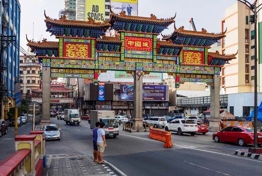
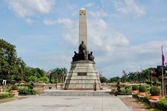
Historic City of Manila, Philippines
Manila is the capital of the Philippines, a heavily populated bayside city on the island of Luzon, which mixes Spanish colonial architecture and modern high-rise buildings. Intramuros is a walled city in colonial times situated in the heart of “Old Manila”. Manila is the multicultural capital of the Philippines that was founded by the famous explorer Miguel Lopez de Legaspi on June 24, 1571. It is the present day city within the National Capital Region or also referred to as Metropolitan Manila
It is home to the baroque 16th-century San Agustin Church and Fort Santiago, a former military prison. Manila incorporates the former pre-Hispanic kingdoms of Tondo and Maynila. It became the capital of the colonial Philippines, with Manila (Intramuros) serving as the centre of colonial power. In 1898, it included the City of Manila and 23 other municipalities. The city’s name is derived from the phrase “May Nilad,” which literally translates to “the place of the nilad,” referring to the flowering mangrove plant that grew in abundance centuries ago on the muddy shores of Manila Bay. Even in Pre-Hispanic times, this ancient city traded with India and China as it was once a part of two powerful Hindu empires, the Srivijaya that ruled Sumatra, and later, the Majapahit empire based in East Java.
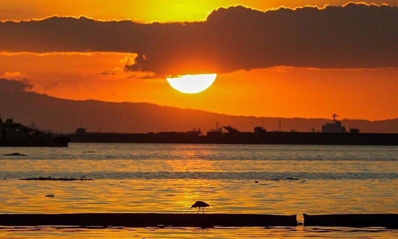
The City seal of Manila, which shows a pearl embedded in a shell appropriately describes the city as the “Pearl of the Orient” because of its vivid location and astonishing golden sunsets viewed from the shores of enchanting Manila Bay. Tagalog is primary the local language of Manila, and this dialect is often called “Pilipino.” English is widely spoken as a second language and many people moved or work to Manila from other regions of the country, bringing with them other Philippine languages/dialect like Cebuano (Visayan) and Ilocano to mention few. This lively historic city is full of things to see and do — including museums, parks, theatres, shopping malls and variety of restaurants to choose from.
May, 2023


Magatas - My Home Barangay (Village)
I was 20 years old when I left Magatas, a very subtle barangay (village), town of Sibulan, province of Negros Oriental. At that time, living in Magatas is simple, laid-back and surrounded with lush and abundance of trees, banana plantation and oil-lamp at night. Magatas has a quite strategic location, being beside a very weather-temperamental "Okoy" river - Okoy means "will surprise you" kind of river. It will just somehow swell without us knowing, although very nostalgic to watch with its fast current flowing out to the sea. It swell because of heavy rains from the mountain area, "the Cuernos de Negros" (or the Horn of Negros), the high mountains of the Negros island and Magatas is base down the low land terrain.
As time passed, many changes built-up and few things gone. There are few developments yet seems the nature been forgotten, less trees, less plantations and it is a bit sad, with climate change added to the change of the landscapes, good and bad, Magatas is continuously thriving and racing with time.
March, 2023


Sibulan - The Main Town (Poblacion)
The Municipality of Sibulan is a second class municipality in the province of Negros Oriental, Philippines. It is a narrow horizontal strip of land that cuts across the southeast of Negros Oriental and faces the mystical island of Siquijor and Cebu across the Tañon Strait. It has an approximate population of 64,343 people. Sibulan is 5 kilometres (3.1 mies) from Dumaguete. It is the location of Dumaguete Airport, the main airport for Negros Oriental. Sibulan is also the location of the Balinsasayao Twin Lakes Natural Park, composed of Lake Balinsasayao and Lake Danao. The site, managed by the provincial government, is located 1,047 metres (3,435 ft) above sea level on Mount Talinis. Sibulan is politically subdivided into 15 barangays (villages) namely - Agan-an, Ajong, Balugo, Boloc-boloc, Calabnugan, Cangmating, Enrique Villanueva, Looc, Magatas, Maningcao, Maslog, Poblacion (main town of Sibulan), San Antonio, Tubigon and Tubtubon
Sibulan has two small Marine Protected Areas, which are coral reef areas that prohibit fishing, swimming and diving. One is in Agan-an, just north of the airport, the other in Cangmating. These were established to improve the sustainability of the local fishery. The inland barangays are primarily agricultural and residential with minimal business and public facilities. Most commercial development is along the national highway, which runs the length of the town from Dumaguete in the south to San Jose at the north. Most business and light industry is along the highway in Boloc-Boloc, Maslog, Agan-an and Poblacion including newly opened 100-bed Negros Polymedic Hospital. This is largely urban sprawl from Dumaguete seeking the advantageous tax rates in Sibulan. Sibulan also boasts a golf course resort, perched on the foothills in barangay San Antonio, just north of the town centre.


Noting the wealth of springs in this area, the Spaniards named it ‘Land of Sibuls’ which meant land of numerous springs. Influence of time, as well as elements of change, got the name of this municipality modified to Sibulan, its present name. In 1838, this town became a Parish under secular order. In 1856, the parish was occupied by a regular church priest. Then, in 1910, Sibulan had its initial set of municipal government officials once it became a municipality. This was in accordance to Act No. 82 of the Philippine Commission dated January 31, 1910. Macario Literal was the first appointed municipal mayor.
April, 2023


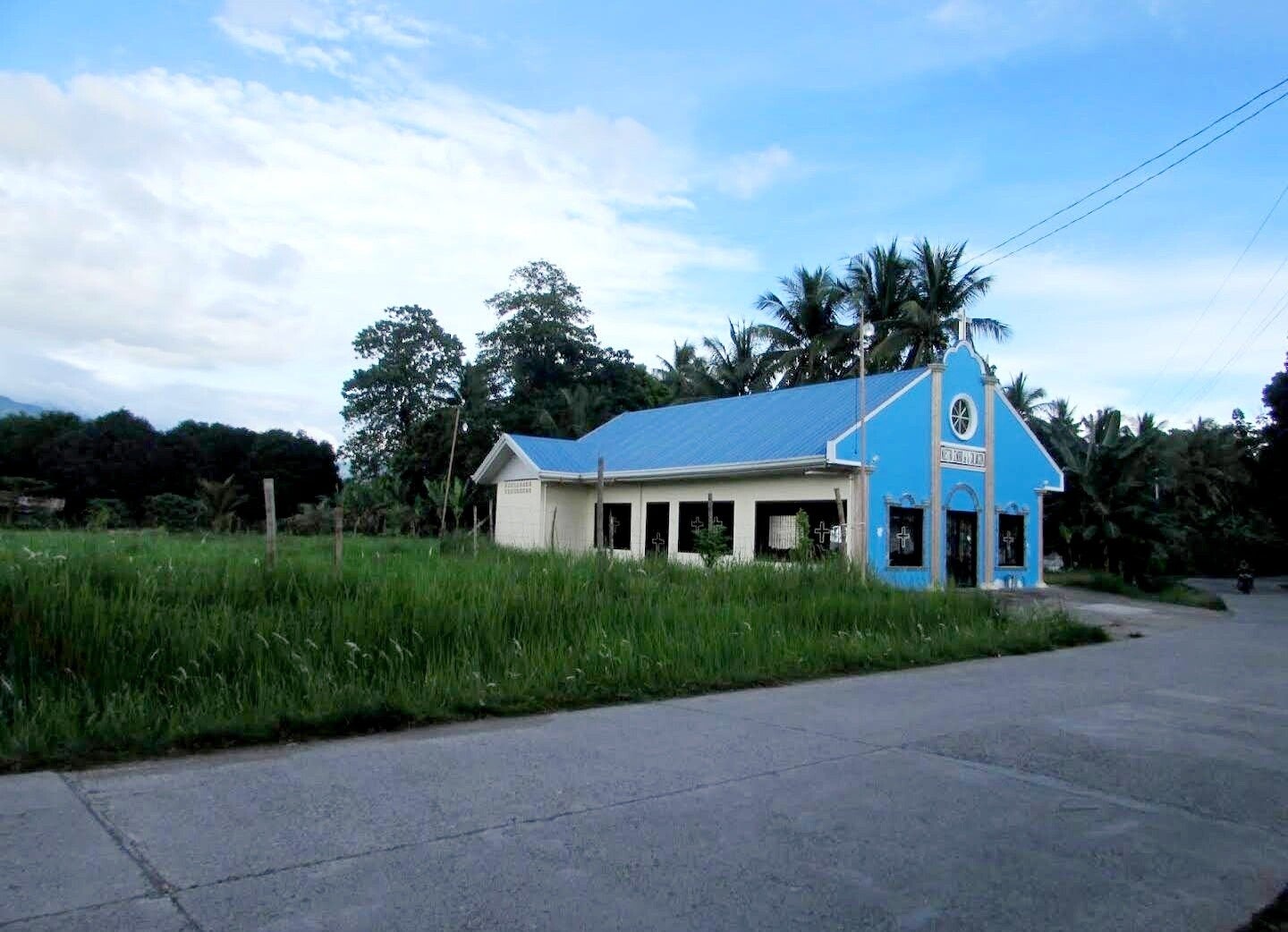
San Antonio de Padua
Known as the patron saint of the poor, of sailors and fishermen, of priests and travelers, a protector and guardian of the mails, and wonder-worker, the story of St. Anthony of Padua is very special.
St. Anthony was born in 1195 (13 years after St. Francis of Assisi) in Lisbon, which is now known as Portugal. Given the baptismal name of Fernando, his parents, Martin and Mary Bulhom, belonged to one of the most prominent families of the city. At the age of 15 Fernando entered the religious order of St. Augustine. Monastery life was hardly peaceful for the youth, nor conducive to prayer and study, since his old friends came to visit frequently and engaged in vehement political discussions. After two years, at his request he was sent to Coimbra (cornbrow). There he began nine years of intense study learning the Augustinian theology that he would later combine with Franciscan vision. Fernando was most likely ordained a priest during this time.
The life of the young priest took a crucial turn when the bodies of the first five Franciscan martyrs were returned from Morocco. The Franciscans had been preaching Christ at a mosque in Seville. They were in danger of being martyred at the outset, but the sultan allowed them to pass on to Morocco, where, after continuing to preach about Christ — despite repeated warnings, they were tortured and beheaded.
To this day, St. Anthony of Padua is one of the Catholic Church’s most revered and popular saints. One of the reasons for this is likely that his life was what every Christian’s life is meant to be — a steady courage to face the ups and downs of life, the call to love and forgive, to be concerned for the needs of others, to deal with crisis, both great and small, and to have our feet solidly on the ground of total trusting love and dependence upon God.
In the spirit of our fellow Franciscan, St. Anthony of Padua, may God bless you.
