Amazing Landscapes of Philippines
Most images are linked, just tap and will lead you to the details
Discovery-Guelos - Green Earth Awareness 2024


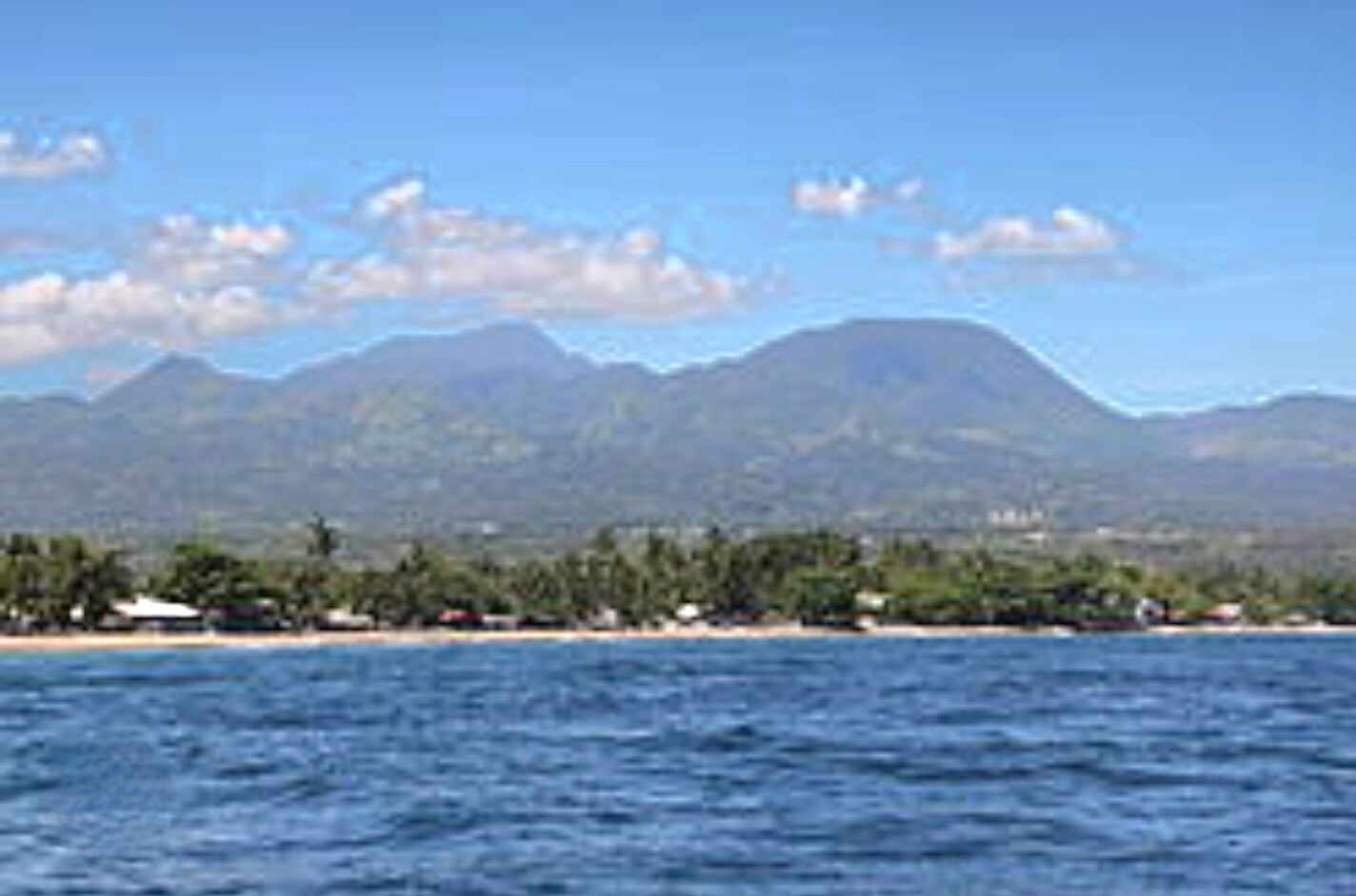
Cuernos de Negros - The Last Frontier of Negros Oriental, Philippines
28 April 2024

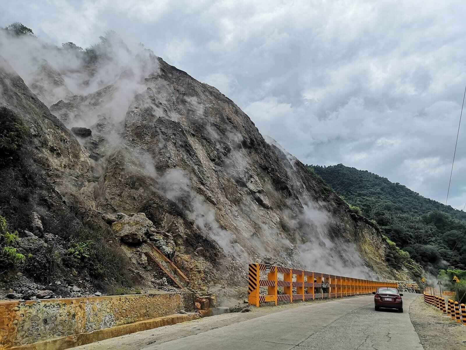
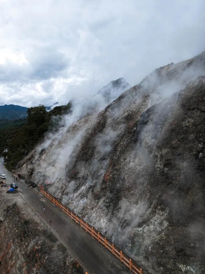
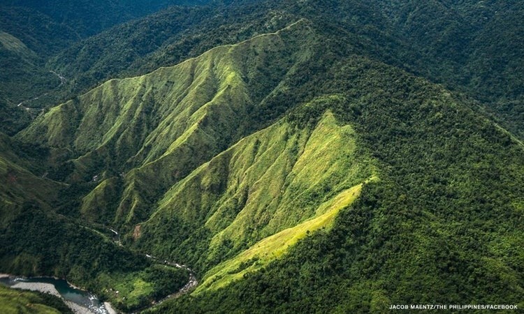
Cuernos de Negros (literally mean “Horns of Negros”/locally as Mount Talinis, also known as Magaso) is a large stratovolcano complex that anchors the southeast tip of the Negros Island, central Visayas region, Philippines.
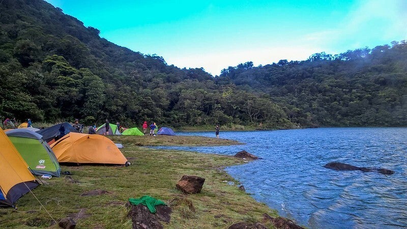
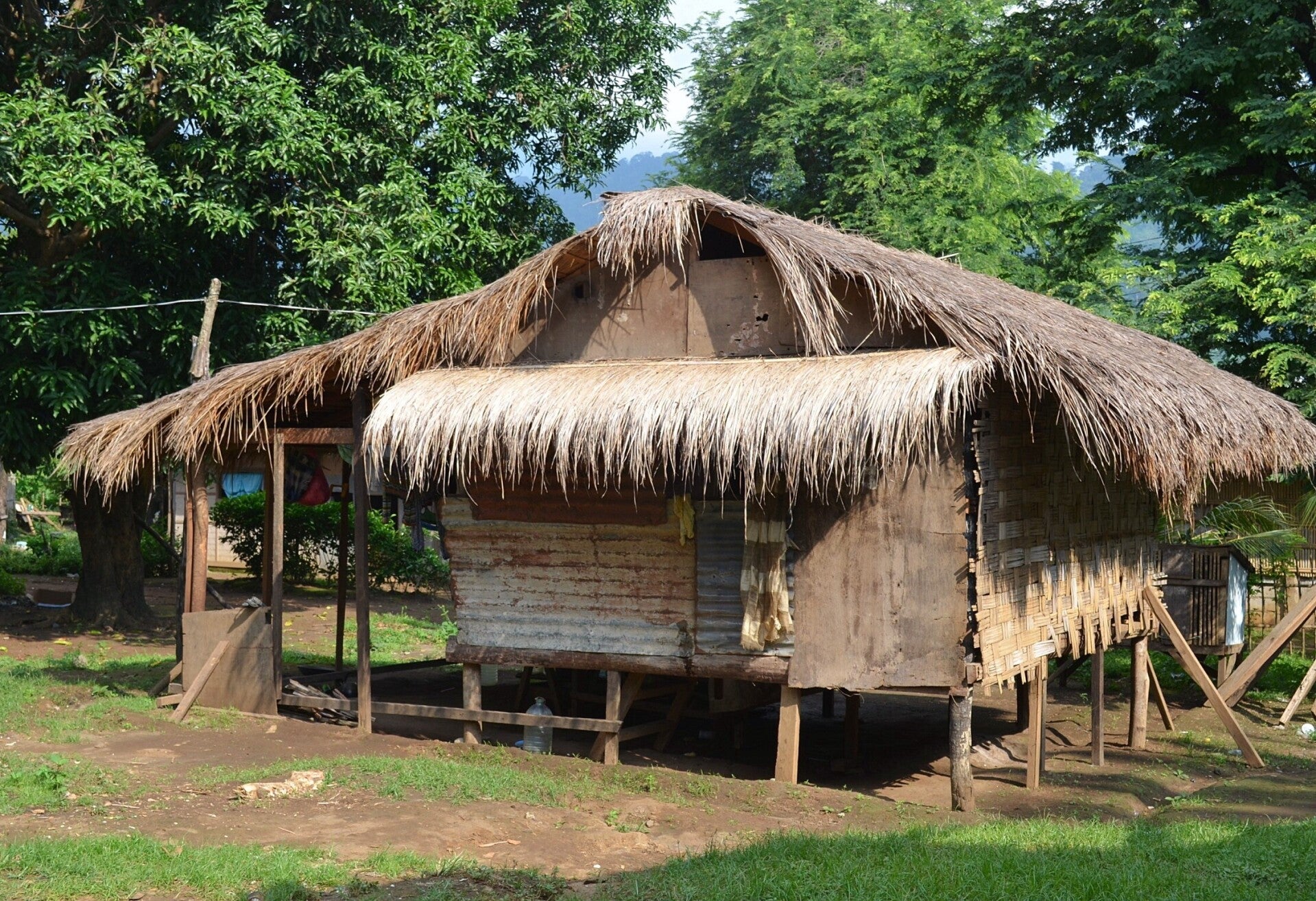
Getting to Mount Talinis would take almost a day to get to the summit and you must be rather in good shape and start extremely early at daybreak. The recommended plan is to coordinate with a Dumaguete City travel agency or check your hotel or guest house other safe recommended group tours and treks. Some people prefer camping near Lake Nailig, approximately 5 miles off Valencia town . Overnight stays in basic cottages near the mountain with local permission, however your own provisions of food, drinking water and relevant outdoor equipment are highly recommended. Adventures in Mount Talinis is much awaited by campers and trekkers as you will come across one of the four Mount Talinis’ crater lakes, where you can swim or do fishing catching fish like carp and tilapia and just grill it in an open fire while enjoying the captivating scenery surrounded by lush trees and exotic fauna and flora.

The youngest radiocarbon date obtained was 14,000 years (Before Present) from a lava flow made of dacitic breccia (a rock composed of large angular broken fragments of minerals or rocks cemented together by a fine-granular matrix) and a younger andesitic unit (lava forming thin capping unit) is present. An increase in fumarolic activity took place after a major tectonic earthquake in 1902. The Palinpinon geothermal field is located south of the Okoy River on the north side of the volcano.


Valencia is a municipality in the province of Negros Oriental, located 9 kilometers or 5.6 miles west and uphill of the provincial capital Dumaguete City. The municipality has 31,477 inhabitants, according to the national census data from the year 2010. In the year 2007 Valencia was voted as “the greenest and cleanest” town of the Negros Oriental Province. The municipality has as a patron saint, Our Lady of the Abandoned, with a town fiesta commemorating her feast day celebrated every year on October 12. The municipality is divided into 24 barangays. In Valencia, the Cebuano dialect is commonly spoken but English is also widely used.

Dumaguete City – the capital of Negros Oriental – is known as the City of Gentle People and University town. Located in region 7, Central Visayas, the charming city became one of the hot-spots for tourists from all over the world. It is a vibrant city which makes its way into the heart of each visitor immediately. While diving is since may years the main attraction of the region, the City government put much effort into promoting the land-based tourist attractions of Dumaguete and Negros Oriental.

Negros Oriental, a laid-back province situated in the southeastern portion of Negros Island, Visayas, Philippines. Surrounded on the north and west by its neighboring province, Negros Occidental; the province is a breathtaking mix of culture and modernization. Dumaguete City is the capitol of Negros Oriental. The government is also located in the capitol area of the City. The province is divided from Cebu Island by the Tañon Strait. Siquijor Island and the dive paradise of Apo Island lay also to the east. The northern parts of Mindanao can be seen in good conditions from the south of Negros Oriental.
Images around Cuernos de Negros


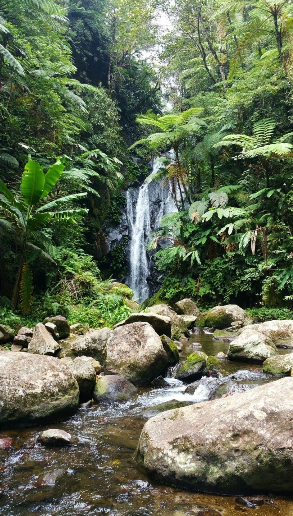


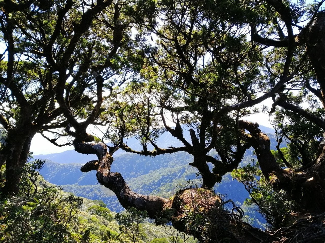
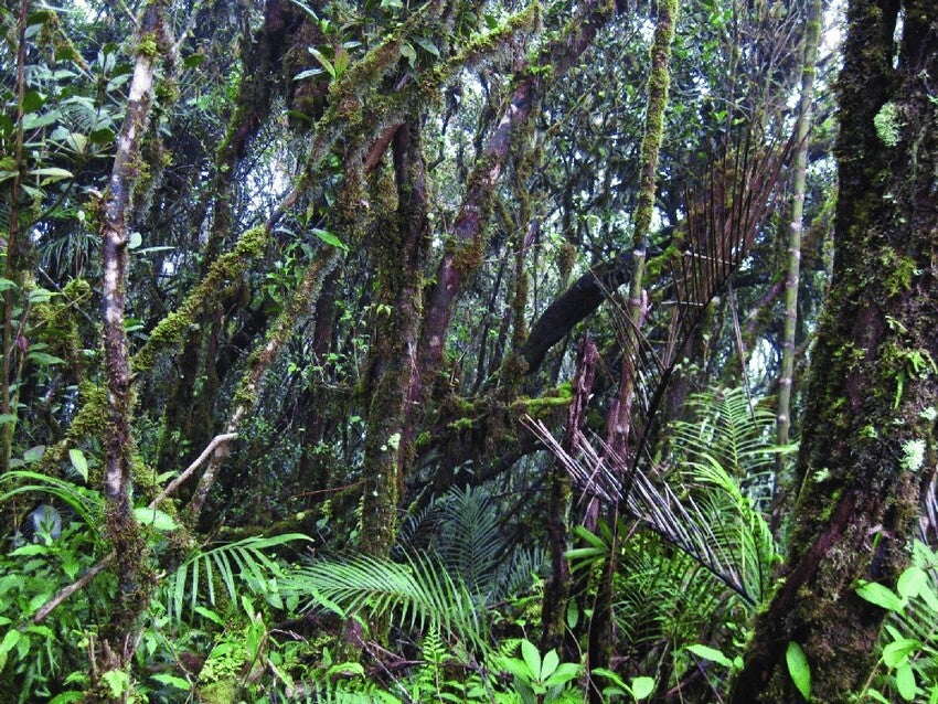
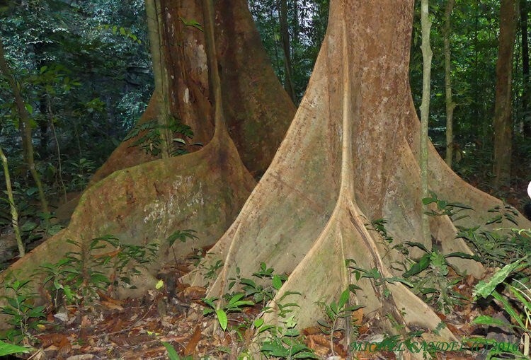
Mt. Talinis or Cuernos de Negros mountain range in Negros Oriental, Visayas region of Philippines, has been identified as a Key Biodiversity Area (KBA) spanning 23, 565 hectares covering the municipalities of San Jose, Sibulan, Dauin, Zamboanguita, Siaton, Sta. Catalina, Pamplona, Amlan and Valencia. It has been identified as one of the top on the list of conservation priority areas due to its high indigenousness and severity of threats. Old growth forest still surrounds the peak and lakes covering an area of about 4800 hectares. About 3000 hectares is classified as close natural forest while about 1800 hectares is secondary natural forest. This remaining forest patch is not only a habitat to wildlife but also serves as water source for the entire southern part of Negros. This mountain is not only home to rich biodiversity of flora and fauna with high indigenousness but it is also an identified watershed providing water to about 15 municipalities and cities in the southern part of Negros Oriental. It is the remaining 1% natural forest of Negros Oriental, the islands’ last frontier.


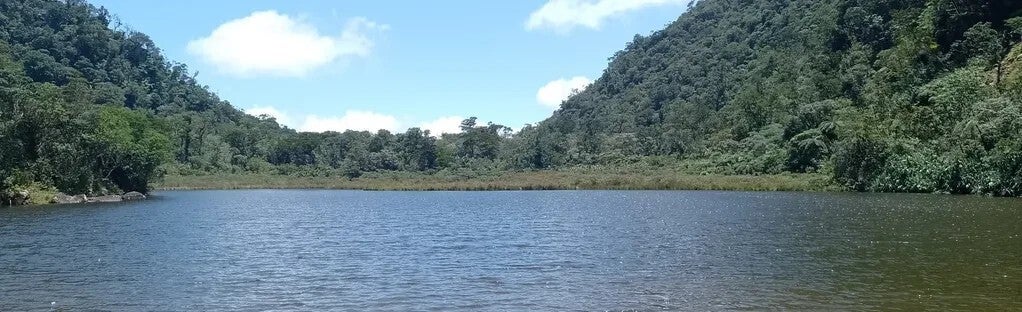
Cuernos de Negros/Mount Talinis is known for having the highest peak in the province of Negros Oriental. Mount Talinis is one of Negros Oriental’s most visited places for those who love nature and for the avid mountain climbers who can harbour a serious passion for what they do. Mount Talinis rises 1864 metres above sea level and is located in Valencia in Negros Oriental. On some hillsides found near Mount Talinis, agricultural has been developed and other areas have been cleared for such purpose. Near Mount Talinis you will find a few small crater lakes at its base called twin lakes of Balinsasayao and Lake Danao. You will also find forests and ranges that are still covered with moss and moss-covered slopes. When you reach the top of the mountain you will see a breathtaking view of the southeastern portion of the Province of Negros Oriental.
One of the most visited area in Negros Oriental are the Twin Lakes of Sibulan. It is composed of two small but deep fresh water lakes called Lake Balinsasayao and Lake Danao. On a clear day, the blue of the sky is reflected in the water of the Twin Lakes, giving a perfect atmosphere for relaxation. The lakes are embraced on all sides by narrow mountains thick with exotic plant-life. When mist obscures the mountains, the area looks like something out of a fairytale or legend. Just like traveling to a mystical land in a story, getting to the Twin Lakes is something of an adventure. Once a visitor arrives, the relaxing atmosphere will wash away any unwanted stress.

Cuernos de Negros (literally mean “Horns of Negros”/locally as Mount Talinis, also known as Magaso) is a large stratovolcano complex that anchors the southeast tip of the Negros Island, central Visayas region, Philippines. The eastern side of the complex consists of two stratovolcanoes and a lava dome; two crater lakes up to 1.5 km in diameter are present. The lower western part of the complex contains four volcanic centres. The small summit crater of Magaso, the highest peak of the complex, rises above the city of Dumaguete and contains fumaroles (an opening in or near a volcano, through which hot sulphurous gases emerge) where two sulfuric springs are found on the east of southeastern flank, with hot springs on the northeast flank.


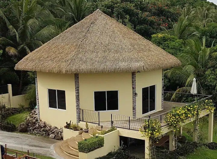
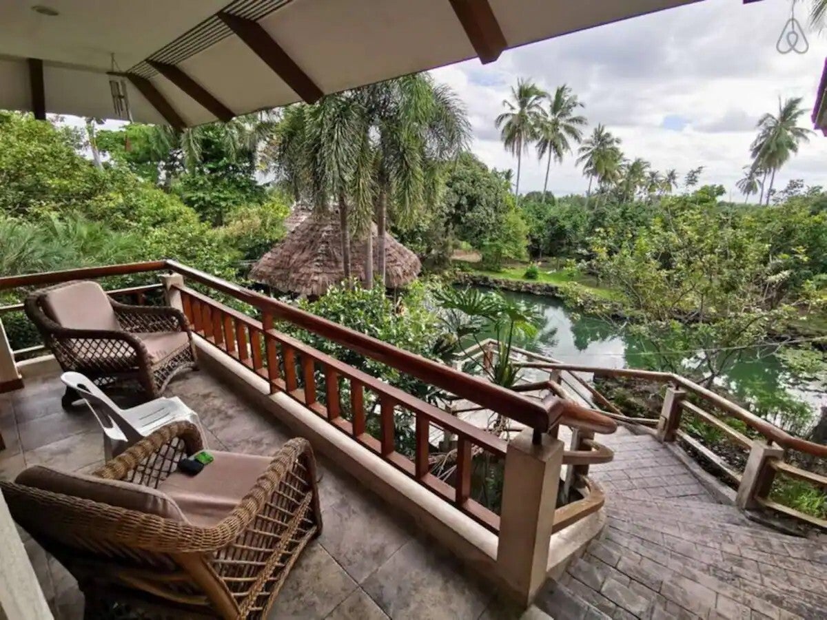
Accomodations


References:
IAVCEI, 1973-80. Post-Miocene Volcanoes of the World. IAVCEI Data Sheets, Rome: Internatl Assoc Volc Chemistry Earth's Interior.
Neumann van Padang M, 1953. Philippine Islands and Cochin China. Catalog of Active Volcanoes of the World and Solfatara Fields, Rome: IAVCEI, 2: 1-49.
PHIVOLCS, 2018-. Volcanoes of the Philippines. https://www.phivolcs.dost.gov.ph/index.php/volcano-hazard/volcanoes-of-the-philippines.
Rae A J, Cooke D R, Phillips D, Zaide-Delfin M, 2004. The nature of magmatism at Palinpinon geothermal field, Negros Island, Philippines: implications for geothermal activity and regional tectonics. J. Volcanol. Geotherm. Res., 129: 321-342.
Solidum R U, Castillo P R, Hawkins J W, 2003. Geochemistry of lavas from Negros Arc, west central Philippines: insights into the contribution from the subducting slab. Geochemistry Geophysics Geosystems, 4: 9008. https://doi.org/10.1029/2003GC000513
von Biedersee H, Pichler H, 1995. The Canlaon and its neighbouring volcanoes in the Negros Belt/Philippines. J Southeast Asian Earth Sci, 11: 111-123.


Kinaiyahan Forest Park, An Eco-Friendly Escapade in Bohol, Philippines
Bilar, Bohol, Philippines 03 December 2023


'Kinaiyahan’ meaning the natural environment, or anything associated with existence by nature and controlled by nature. This is where the Kinaiyahan Forest Park concept started on a 17-hectare forested area in barangay Zamora, Bilar town.

Bilar, officially the Municipality of Bilar, is a 4th class municipality in the province of Bohol, Philippines. According to the 2020 census, it has a population of 18,512 people. The town of Bilar, Bohol celebrates its fiesta on May 15, to honour the town patron Saint Isidore the Farmer. Bilar is an interior town northeast of Loboc. This town used to occupy a big area and included what are now known as municipalities of Sevilla, Batuan and Carmen. The term “bilar” is a native word from the infinitive “nagbilad” literally means "exposed under the sun".
Dining and around Kinaiyahan corners


Kinaiyahan Forest Park has started to plant 5,000 bamboos during the observance of the World Bamboo Day way back in 2021. The park then projected to have 20,000 bamboos planted within the year 2021 and in 2023, it become a picturesque of wide varieties of bamboo in the massive space of the nature park and now a natural attraction in Bilar, Bohol surrounded by gilded greenery, tall trees, and bamboo structures all around the area. The Kinaiyahan Forest Park is a sanctuary for nature lovers and adventure seekers, recommending a unique and immersive experience in these rare, natural attractions. It is a haven for those in search of tranquility and a deep, relaxing connection with nature and the laid-back feel of Bohol
Around Kinaiyahan
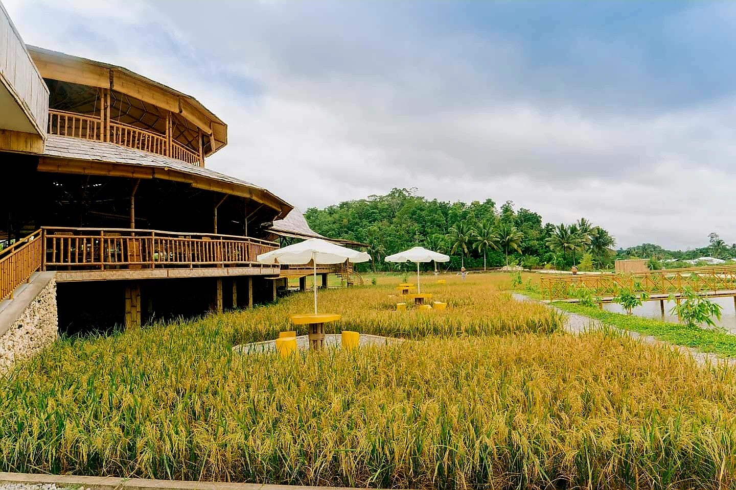


The Kinaiyahan Forest Park is ideal for relaxation and winding down amongst the sense of nature and for breaking away from a busy and pressured city lifestyle or just mainly time-off of everyday life. The park is showcasing picture-perfect bamboo arches, a enormous space with tables and comfortable chairs to relax, an indoor treehouse, bamboo swings under the cooling-shades of trees, and an impressive triangular structure that is perfect for a wide-angled photo. There is a modest like lake also at Kinaiyahan Forest Park where bamboo chairs are purposefully placed to admire all the attractions of nature. It is an eco-friendly theme park and sustainable structures harmonizing the innate beauty of the heart of the Philippine islands.


Malangaan Marble Cave
San Rafael, Bulacan, Philippines
Bulacan, Philippines 02 December 2023


Malangaan Marble Cave in the Philippines is situated on the Municipality of San Rafael province of Bulacan bounded by two provinces, Quezon and Pampanga. San Rafael is predominantly an agricultural town, and its major crop is rice which is the main source of people’s income, along with other produce of corn, root crops, fruits (mostly mangoes) and vegetables. Livestock and poultry production are the other agricultural source in the municipality.
San Rafael aimed for a wider development including tourism and this town has the high potential as tourist destination. The Malangaan Caves in the village of Tukod, the San Rafael Church, the San Rafael Retreat Farm and the Eight Waves Water Park resort are among sites that will surely attract more national and international visitors.

San Rafael was established as a pueblo in 1750. The San Juan de Dios Church still stands as the silent witness of the bloody battles that the Filipino insurgents fought during the Philippine Revolution of 1896. This church was used as military barracks for almost three days, after the insurgents had destroyed all papers and documents they found in the convents. When the Spanish Cazadores learned of these rebellious activities, they entered the church and fought the insurgents. The combatants fought heavily inside the church to a point that blood was spilled all over the church floor. The patio in front of the church was littered by dead bodies of Filipino insurgents. The gobernadorcillo ordered people to dig a common grave near the church for the bodies of the insurgents

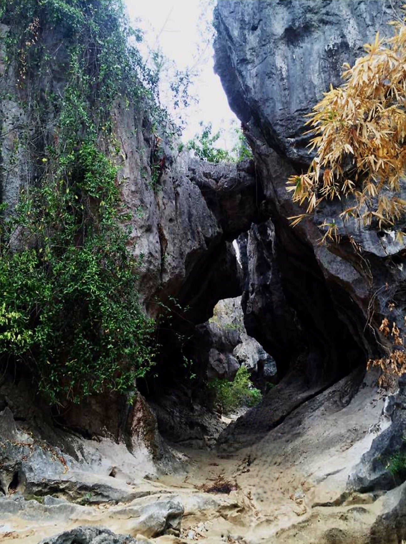
Malangaan Cave, also known as Marble Cave, is just a two hour drive from Manila and accessible by both public and private transportation towards Pulo town and from Pulo it will roughly take about 10 mins drive to Tukod, where the Malangaan Cave is located. The Malangaan Cave and River system located in village of Tukod, San Rafael shares border with neighboring towns of San Ildefonso and Doña Remedios Trinidad or simply known as DRT. Then a short trek heading to the cave, the amazing rock formation all around are mesmerising. During summer time or dry season the area is much like a mini US Grand Canyon.


Sierra Madre - The Magnificent Frontier of the Philippines
Philippines, 08 October 2023

In the north, the range begins in the province of Cagayan and ends in the south in the province of Quezon. In the province of Nueva Vizcaya, the Caraballo Mountains sits between Sierra Madre and Cordillera Central. The mountain range serves as a typhoon barrier, weakening incoming typhoons from the Pacific Ocean before reaching the central mainland. The range's highest point is still unsure, and several peaks are recognised as the highest. Mount Anacuao in Aurora province stands at 6,069 feet (1,850 m), while Mount Cetaceo in Cagayan is of similar altitude. However, an expedition in September and October 2012 to Mount Guiwan (Nueva Vizcaya) preliminarily measured an altitude of 6,283 feet (1,915 m) on the summit.
There are many mountain peaks along the range by elevation approximately measuring from highest which is Mount Bintuod at 6,339 ft (1,932 m) to the lowest which is Mount Malauban at 1,024 ft (312 m). Numerous rivers running within the mountain range from the longest, the Cagayan river at 518 km (322 miles) and the shortest is Kaliwa river at 518 km (322 miles). The Sierra Madre has 9 waterfalls of various stretch and wide. The mountains in Gabaldon and the mountains in Isabela as viewed from Barangay Diddadungan in the town of Palanan Northern portion of the range are two ecoregions cover the Sierra Madre. The Luzon rain forests cover the lower slopes of the range, and characterized by dipterocarp trees, or Dipterocarpaceae is a family of 16 genera and about 695 known species of mainly tropical lowland rainforest trees. The Luzon montane rain forests cover the portions of the range above 1000 meters elevation, and are characterized by laurel forests of oak and laurel trees. And there is one active volcano, the Caqua volcano in Cagayan province and last erupted in 1907.


The Philippines Sierra Madre is the longest mountain range in the country, traversing over 540 kilometers (340 mi) stretching from the province of Cagayan down to the province of Quezon, forming a north–south direction on the eastern portion of Luzon, the largest island of the archipelago. It is bounded by the Pacific Ocean to the east, Cagayan Valley to the northwest, Central Luzon to the midwest, and Calabarzon to the southwest. Some communities east of the mountain range, along the coast, are less developed and extremely remote that they could only be accessed either by air or sea. It is the Philippines largest protected area, the Northern Sierra Madre Natural Park, located at the northern part of the range in the province of Isabela. The park is included in the UNESCO tentative list for World Heritage List inscription. Environmentalists, scholars, and scientists have been urging the government to include the other parks within the Sierra Madre mountains for a UNESCO site that would include the entire mountain range from Cagayan to Quezon.

Sierra Madre is home to Indigenous Dumagat-Remontado groups, are the Aeta or Agta, or Dumagat, a collective terms for several indigenous Filipino peoples who live in various parts of the island of Luzon communities who have ancestral domain claims covering parts of the mountain range. Aeta communities were historically nomadic hunter-gatherers, typically consisting of approximately 1 to 5 families per mobile group. Groups under the "Aeta" umbrella term are normally referred to after their geographic locations or their common languages.
The Sierra Madre mountain range is rich in genetic, species, and habitat diversity, supplying food, water, and shelter to millions of people. The mountain range holds multiple watersheds and some of the Philippines' oldest forests. These forests are some of the country's largest remaining forest blocks, including an old-growth dipterocarp forest, montane forests, and extensive lowland forests. Sierra Madre's forests and watersheds are home to some of the country's richest wildlife communities of more than 291 species of birds and 25 endemic mammals may be found within the Northern Sierra Madre Natural Park alone.
Sources:
-
Coursey, Oscar William (1903). History and Geography of the Philippine Islands. Educator School Supply Company.
-
Bordadora, Norman (November 12, 2006). "Sierra Madre blocks 'Queenie' punch". Philippine Daily Inquirer. Archived from the original on December 25, 2014. Retrieved December 25, 2014
-
Noval-Morales, Daisy Y. "The Remontados of the Sierra Madre Mountains". National Commission for Culture and the Arts. Retrieved April 10, 2021.
-
Centre, UNESCO World Heritage. "Northern Sierra Madre Natural Park and outlying areas inclusive of the buffer zone". UNESCO World Heritage Centre.
-
"Northern Sierra Madre Natural Park". forestry.denr.gov.ph. Archived


Las Casas Filipinas de Acuzar- A Colonial Historical Resort
Bagac, Bataan, Philippines

For more details about Las Casas Filipinas de Acuzar, tap the linked image above.
Las Casas Filipinas de Acuzar is a beach resort, hotel, convention centre and heritage destination located in Bagac, Bataan, Philippines. Jose Acuzar, the owner of New San Jose Builders, Inc., started to rebuild Spanish colonial-era mansions in Bagac in 2003. He was born in June 19, 1955, a Filipino business executive who is the founder of New San Jose Builders. He also serves as the Secretary of the Department of Human Settlements and Urban Development from July 2022 until term completed. In March 2010, the area was opened to the public as the Las Casas Filipinas de Acuzar. It was placed under the management of Genesis Hotels and Resorts Corporation.
The main attraction of the Las Casas Filipinas de Acuzar is the different heritage houses, which were shifted from outside Bagac, Bataan. The houses were disassembled from their original location and reconstructed inside the location of the Las Casas Filipinas. This method called heritage conservation, is an attempt that seeks to preserve, conserve and protect buildings, objects, landscapes or other artifacts of historical significance. It is a philosophical concept that became popular in the twentieth century, which maintains that cities as products of centuries' development should be obligated to protect their patrimonial legacy. The term refers specifically to the preservation of the built environment, and not to preservation of, for example, primeval forests or wilderness has been argued among conservationists since they believed that their original communities could have benefitted from the structures had they been restored on site. The heritage park's advocate Gerry Acuzar claimed that he went with the method in order to save the structures from decay and neglect. The heritage park was acclaimed by the Department of Tourism in 2021 under Secretary Bernadette Romulo-Puyat for its preservation efforts.
The houses included in the Las Casas Filipinas were evaluated for their historical, cultural and architectural merit. Most structures dates back to the Spanish colonial era, but some buildings were built later such as the Casa Lubao which was built in 1920 during the American era. The heritage park also include a torogan, literally a 'resting place' or 'sleeping place', is a traditional ancestral house built by the Maranao people of Lanao, Mindanao, Philippines for the nobility. A torogan was a symbol of high social status, such a residence was once a home to a sultan or datu in the Maranao community. Nowadays, concrete houses are found all over Maranao communities, but there remain torogans a hundred years old. Maranao royal family house from Lanao in Mindanao is a predominantly Muslim Filipino ethnic group native to the region around Lanao Lake in the island of Mindanao. They are known for their artwork, weaving, wood, plastic and metal crafts and epic literature. The Darangen, are ethnically and culturally closely related to the Iranun, and Maguindanao, all three groups being represented as speaking Danao languages and giving name to the island of Mindanao. They are grouped with other Moro people due to their shared religion.
Among the notable houses shifted to the heritage park are - Casa Bizantina, Casa Hidalgo, Casa Jaen I and Casa Unisan. Casa Bizantina, is a heritage house museum originally located at San Nicolas, Manila. It was transferred and reconstructed in 2009. It was designed by a Catalan architect Joan Josep Jose Hervas y Arizmendi, in 1890. It is the only existing building designed by the Architect Arizmendi in the Philippines. In addition to that, it was cited by Tribune magazine in 1939 despite its neglected state.
Casa Hidalgo is a heritage house originally located in Quiapo, Manila, owned by Rafael Enriquez, a Spanish peninsular and painter (1850–1937). The house was built in 1867, one of the first projects of Architect Felix Roxas y Arroyo. Some of his notable works were Paterno House and Zamora House in Quiapo, Manila and the 1867 Santo Domingo Church in Intramuros, Manila. However, a carving on king post, stating "1807", indicates that the house was built before Rafael Enriquez occupied the house. This was discovered in 2006, wherein the house was dismantled and relocated at Las Casas Filipinas de Acuzar.
Casa Jaen I is a heritage house museum originally located at Jaen, Nueva Ecija built during the 1900s. Being the second house of the Esquivel family at Jaen, Nueva Ecija, it served as the venue for the homecoming of his son, Emmanuel Frias Esquivel, who studied in the United States. Their first house, which is also located at the same municipality, was built in 1890. It won a House Beautiful Award in 1917 by the Sunday Tribune. Other houses that have won the award were the El Nido, or Eugene Arthur Perkins residence in 1927 and La Casona, or Jacobo Zobel Mansion in 1928 , all designed by Andres Luna de San Pedro.
Casa Unisan is a heritage house museum originally located in town of Kalilayan in Tayabas province, which Unisan now is Quezon at present. It was built in 1839 by Don Antonio Maxino. The house was claimed to be the first bahay-na-bato of the municipality. In 2007, the half-ruined house was sold to Jose L. Acuzar by a remaining family member. Unfortunately, the rest of the Maxinos were massacred by bandits, or tulisan.
Las Casas Filipinas de Acuzar also accommodates a small church known as the Sanctuario de San Jose, other features includes the Napiya Spa, a swimming pool. The Tulay ni Lola Basyang is a bridge that crosses the Umagol River and is a replica of the old Puente de España in Manila. The Puente de España, or the Bridge of Spain, was a bridge that spanned the Pasig River in the Philippines, connecting the areas of Binondo and Ermita, Manila on Calle Nueva, now E.T. Yuchengco St., within central Manila. The span was the oldest established in the country before it was damaged by flood in 1914. The bridge was replaced by the Jones Bridge that was started in 1916 and completed in 1921, located one block downriver from Puente de España on Calle Rosario, now Quintin Paredes St.
References:
Las Casas Filipinas - a New San Jose Builders project". Las Casas Filipinas de Acuzar. Retrieved 21 January 2013.
Orejas, Tonette (29 April 2012). "Where memories, heritage line the streets". Philippine Daily Inquirer. Retrieved 7 March 2021.
"Las Casas Filipinas de Acuzar reopens – The Manila Times". Manila Times. 16 June 2020. Retrieved 7 March 2021..
Quismorio, Ellson (31 January 2021). "DoT chief cites Las Casas' way of preserving local historical sites". Manila Bulletin. Retrieved 7 March 2021.
"Tales of love, lust, and murder at Las Casas Filipinas". GMA News Online. 4 January 2014. Retrieved 7 March 2021.


Tap the linked images below to book air tickets from our partner airlines


The thousands of islands in the Philippines
Play the video selections and be amazed
Destination: Palawan, Philippines
Video Courtesy of Palawan Tourism
Travel video courtesy of Touropia
Destination: Negros Oriental, Philippines
Video Courtesy of Dumaguete Tourism
Manila, Philippines (Video courtesy of Exploropia)
Destination: Ilocos Norte, Philippines
Video Courtesy of VPI Travel Ilocos
